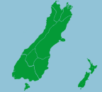

The South Islanders often call their island "the Mainland". Less populated than the North Island, the South Island has a beautiful and diverse landscape to explore.
The Maori name for the South Island is Te Wai Pounamu, which means "The Greenstone Water" or Te Waka a Maui, which means "Maui's Canoe".
The mountain chain of the Southern Alps runs down the South Island. There are many great ski fields on the Southern Alps, including Mount Hutt and The Remarkables, which attract locals and overseas visitors alike during the winter season. During the summer the alps are enjoyed by hikers and mountain bikers to name but a few of the numerous activities. Aoraki/Mount Cook is the highest point on the Southern Alps.
Main regions of the South Island
Tasman - Nelson
Marlborough
West Coast
Canterbury
Queenstown - Wanaka
Otago
Southland
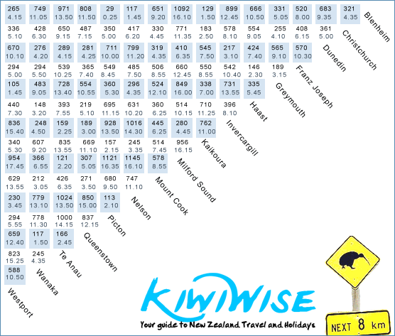
South Island Travelling Distances & Times
The chart below is a convenient way of finding the travelling time and distance between any two points in South Island. The times shown are in hours and minutes and are based on an average speed of 80 Km/h with an allowance for a brief stop every hour.

Major Regions, Cities & Towns of South Island
Akaroa, Alexandra, Arthur's Pass, Ashburton, Blenheim, Bluff, Canterbury, Cardrona, Christchurch, Collingwood, Dunedin, Fairlie, Fiordland, Fox Glacier, Franz Josef, Gore, Greymouth, Haast, Hanmer Springs, Havelock, Hokitika, Invercargill, Kaikoura, Lake Ohau, Lake Tekapo, Lewis Pass, Manapouri, Mapua, Marlborough, Methven, Milford Sound, Mosgiel, Motueka, Murchison, Nelson, Oamaru, Omarama, Otago, Owaka, Papatowai, Picton, Portage, Punakaiki, Queenstown, Queenstown - Wanaka, Richmond, Riverton, Southland, St Arnaud, Stewart Island, Takaka, Tasman - Nelson, Te Anau, Timaru, Upper Moutere, Waiau, Waimate, Wanaka, West Coast, Westport


